

To the Kotelske pass
Horeni Domky – ascend along the Blue course – follow the blue-marked tourist trail to the Zadni Plech intersection – follow the yellow-marked tourist trail to the Krakonosova snidane junction – follow the blue-marked tourist trail (Harrachova Trail) and ascend to the ‘U Ctyr panu’ junction – follow the green-marked tourist trail (Czech Trail) – Ruzencina zahradka junction – follow the red-marked tourist trail to the Kotelske pass.
Length: 11,9 km
Explanations of Symbols
- Hard-to-orientate terrain
- Avalanche risk terrain
- Hard-to-orientate and avalanche risk terrain
- Other warnings; steep gradient
Under certain climatic conditions, life threatening circumstances and/or hard-to-orientate parts may occur on this route. Entry solely at your own risk! Contact the Mountain Rescue Service for the latest information.
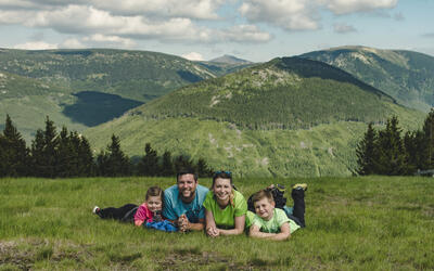
Fill your family time in the Krkonose Mountains with movement in nature, exploration, fun and fairy-tale adventures. We've chosen the best places for you, planned routes, prepared an adventurous stamp hunt and know where to hide in bad weather.